Blog
Detail Guide for Traveling to Ha Giang by Motorbike - Explore Real Asia

Please log in to continue

Detail Guide for Traveling to Ha Giang by Motorbike - Explore Real Asia
April 26, 2021
Ha Giang has always been a dream destination for those who are passionate about travel. Each person chooses their own journey, a way of going and feeling. In this article, Explore Real Asia will provide you with detailed information about traveling to Ha Giang by motorbike, an interesting way to fully enjoy the trip.
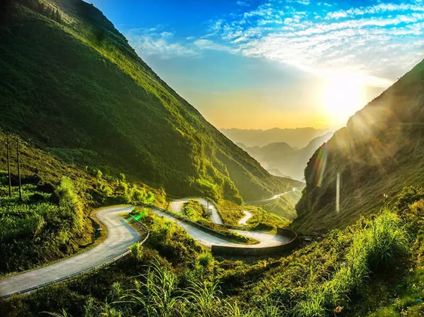
Ha Giang is located in the North Pole of Vietnam. There are many majestic mountains, with Tay Con Linh peak (2419 m) and Kieu Lieu Ti (2402m) being the highest. Ha Giang has many famous landscapes such as Dong Van plateau, Lung Cu flagpole, Meo Vac, Quan Ba mountain, Vuong family. There are also special festivals of the nation here.
If you have not been to Ha Giang before, you can arrange a trip to Ha Giang from Hanoi according to the time you have free time because Ha Giang is a destination that, according to locals, "every season is beautiful". Many visitors like to come to Ha Giang at the end of the year from around September to March. During this period, you can admire the great beauty of Ha Giang in the season of ripe rice, triangular flower season, and mustard flower , cherry blossoms, plum blossoms.
Before and after the Lunar New Year. Coming to Ha Giang this season, you will feel the joyful atmosphere in the fields. You can watch cherry blossoms, pear blossoms and then bloom.
June-August: cool, sunny weather is the perfect time for you to explore the majestic and immense rocky highlands.
September: ripe rice season in highlands. Ha Giang was immersed in the golden color, enthusiastic working atmosphere and cheerful eyes of many ethnic minorities.
October to November: the season of flowers is a triangular circuit. Around the 3rd week of October to the beginning of November is the time when the flowers are most beautiful.
December: Coming to Ha Giang to feel the numb cold and snow falling in the northern mountains. You can sip a cup of dark corn wine, sit by the fire rose, drink a bowl of hot porridge, ... what else is better?
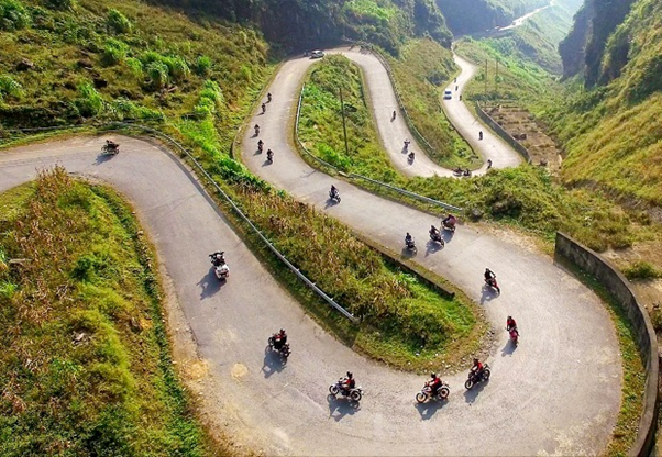
Traveling to Ha Giang by motorbike
From Hanoi city to Lang - Hoa Lac, in the direction of Thang Long Avenue. Then go towards Highway 21 to Son Tay. From Son Tay, cross Trung Ha bridge to Co Tiet and then cross Phong Chau bridge, take road 32 to Phu Tho province, turn left onto NH2. Then, you continue to run straight to the roundabout at Highway 2C, Ham Yen, Tuyen Quang. At this point, you just continue the journey as guided on the first route to reach Ha Giang province.
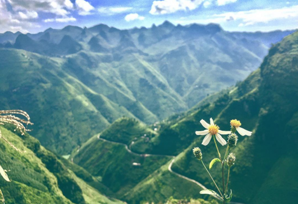
From Ha Giang city, 4 districts of Quan Ba, Yen Minh, Dong Van and Meo Vac
These are the main districts where the Triangular Flower Festival will take place.
There are so many beautiful roads and places that you can only enjoy the beauty of it only by traveling to Ha Giang by motorbike. Explore Real Asia will list some of the specific locations below.
Ma Pi Leng passes through three communes of Pai Lung, Pa Vi and Xin Cai (Meo Vac) in Ha Giang province - is a rugged pass about 20 km long over the top of Ma Pi Leng. Ma Pi Leng Peak has an altitude of about 1,200 meters in the Dong Van Plateau, located on Happy Street linking Ha Giang City, Dong Van and Meo Vac town.
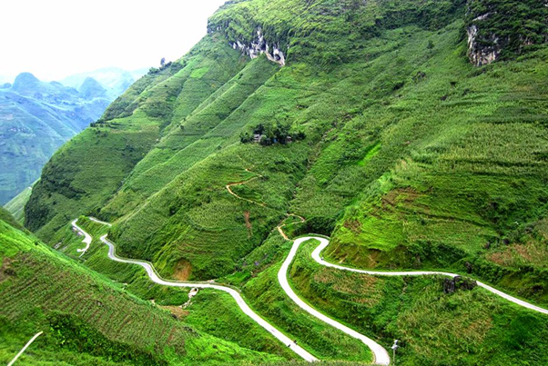
This pass is one of the "four great passes" in the Northwest and is also one of the most beautiful passes in Vietnam - the dream of conquering any genuine adventurer.
The landscape of this area is rocky, in which the deep valley of the Nho Que river is cut in half, one side is the top of Ma Pi Leng and the other is the slope of Sam Pun (Sam Pun), where there are border markers and the border gate. from Xin Cai to Dien Bong, China.
Dong Van rocky plateau (or Dong Van plateau) is a rocky plateau spreading over four districts of Quan Ba, Yen Minh, Dong Van, Meo Vac of Ha Giang province, Vietnam.
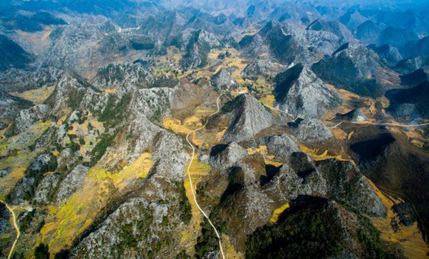
On October 3, 2010, the record "Dong Van Plateau Geopark" was officially recognized by UNESCO's Global Geopark Network Advisory Council (GGN) as a Global Geopark. . This is currently the only title in Vietnam and the second in Southeast Asia.
Yen Minh is about 100km northeast of Ha Giang city, along Highway 4C running from Can Ty to the center of district town through three communes: Bach Dich, Na Khe, Lao And Chai has a dreamlike road that makes you like standing in the middle of Da Lat dreaming.
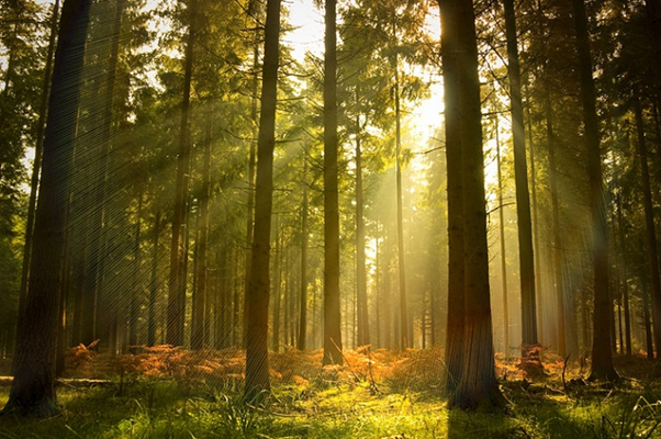 |
|The beautiful road of Yen Minh pine forest starts from the section of Na Khe commune to Yen Minh town, the section of national highway 4C with both sides of the road.
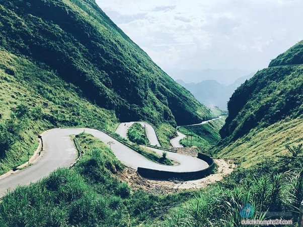
Legend says that in the past, people let their horses pack their goods from the bottom of the slope up, and the horse that reached the top was strong enough to keep raising so the slope was named Tham Ma. This is the first pass that you need to conquer to step foot on the Dong Van plateau land. After you pass this slope, you will reach Cao Street.
From Yen Minh to Dong Van town, to Pho Bang junction, where a beautiful pass embracing a green valley is the highest and most beautiful point for panoramic view of Sung La. This place can be considered as the most beautiful upland commune of the whole Dong Van rocky plateau.
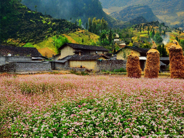
Looking down from the middle of the road, you will see Sung La as a peaceful and beautiful natural picture. Sung La is located among the rocky mountains of undulating, one-color dark, solid houses with fading roofs of time.
The road kept going round and round from mountain range to mountain range, the sun kept jumping halfway up the sky and the valley was so deep that there was no shadow of people until suddenly Pho Bang appeared with a valley of roses. Behind the clouds of rose flowers, the small Pho Bang lies beside the cat-ear rocky mountains. The whole town has only a few dozen roofs, scattered on the main road and a few small branches.
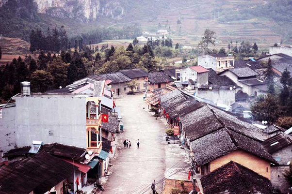
The reported houses are more than a hundred years old, the old wooden doors are glued with old Chinese words, the mossy brown walls, the yin-yang tiled roofs. Simple life passes every day.
The residence of the Meo King, the name used in the documents is the residence of the Vuong family, also known as the King House, located in a valley in Xa Phin commune, Dong Van district, Ha Giang.
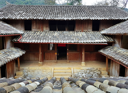
The entire residence of King Meo has an area of nearly 3,000 m2, was started in 1919 and completed 9 years later, in 1928. The construction process costs 15,000 Dong Duong white silver coins, equivalent to 150 billion VND today.
Lung Cu flagpole is a national flagpole located at the top of Lung Cu, also known as the summit of Dragon Mountain (Long Son) with an altitude of about 1,470 m above sea level, in Lung Cu commune, Dong Van district, Ha Giang province. where the northernmost point of Vietnam. From the top of the flagpole looking down to the ground, there are 2 ponds on both sides of the mountain that never run out of water, called the dragon's eye, which is the water source for the ethnic people of the two villages to use.
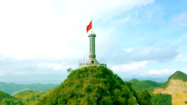
Lung Cu flagpole is not actually the North Pole of Vietnam, this real pole is located under the Nho Que River, where it takes a whole day of traveling with the guidance of people who know you to come. . Currently, about 3km from Lung Cu flagpole, another iconic North Pole was built in Xeo Lung village.
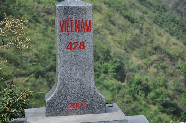
Landmark 428 is not the northernmost point, but it is the most northern landmark of the country, this is the most Vietnam-China border landmark with the northernmost point. The landmark is about 500m from the Nho Que river along the way the birds fly. Nho Que River is a common river of Vietnam and China, so it is also the boundary of the two countries.
At Xeo Lung village (about 3km from Lung Cu flagpole) is a symbolic northernmost point. Up to the present time, this is the closest accessible point to the north pole of the country. Standing on the observatory (simulating One Pillar Pagoda) covering the boundary strip of the North Pole cone, where the Nho Que River begins to flow into Vietnam.
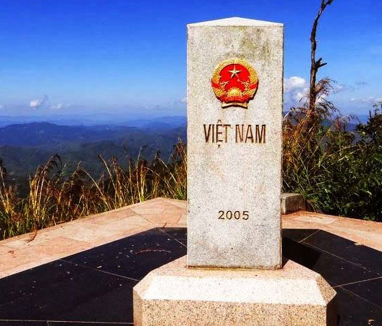
Conquering landmark 428 and North Pole Landmark are one of the great experiences in Ha Giang that you will definitely never forget.
Dong Van Old Town is located in Dong Van town, Dong Van, Ha Giang. The center area of old Dong Van town belongs to Dong Quan, Nguyen Binh Chau, Tuong Van, Tuyen Quang province and has a history of architectural and cultural development for hundreds of years.
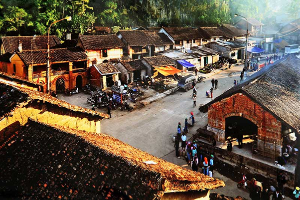
The AQ was formed in the early 20th century, initially only a few families of the Mong, Tay and Chinese lived, gradually more local residents came to.
Dong Van Market is an old market, located in the population of Dong Van old town, this is the largest center of economic exchange, commodity exchange and culture in the Dong Van rocky plateau.
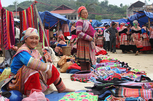
Every week the market has a single session on Sunday. On the day of the fair, the small, quiet old town became noisy and crowded like a festival with colorful costumes of the Dao, Mong, Tay, Nung, Giay, Lo Lo ..., pouring from Reclining the mountain to the market.
Khau Vai market (Khau Vai in Tay language, Nung means pass of gai) also known as Phong Luu market, Khau Vai love market, has been around for nearly 100 years. Sources say since 1919.
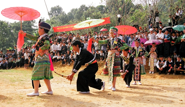
The market is located in Khau Vai commune, Meo Vac district, Ha Giang province, Vietnam and meets only once a year on March 27 of the lunar calendar. Khau Vai love market, also known as Phong Luu love market, is famous for its unique "unique" on the rocky plateau where the north pole is located.
Pao's house is located in Lung Cam village, Sung La commune, Dong Van district, Ha Giang This is the house of Mr. Mua Sao Pao, from the Mong ethnic group. The two-story house in "The Story of Pao" is like a villa in the rock plateau
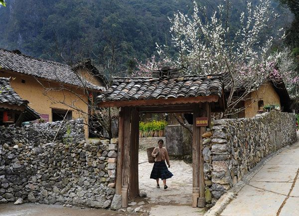
The house "four great roads" was chosen by director Ngo Quang Hai as the filming setting for "The Story of Pao", adapted from the work "The sound of lips behind the rock fence" by writer Do Bich Thuy. The houses here are built according to the walled way, dating back to about 100 years. The main ethnic group is the Mong, accounting for 85%.
Pao's house now becomes a tourist destination not to be missed for visitors every time to Dong Van (Ha Giang). Inside the premises of the house, there are many goods and souvenirs made by the people themselves.